Wow! What a weekend. On Sunday, September 14, the remnants of hurricane Ike traveled up the Mississippi and Ohio River valleys. Ahead of the storm, Wind Advisory and Wind Warnings were issued for the entire area with wind predictions in the 30-50mph range. Well, Ike decided to bring his strength all the way to our area and flexed his muscles to Hurricane strength. Across the area, wind gusts of 70-90mph were recored. A hurricane is defined as a storm with sustained winds of 74mph! We certainly had that at times. My own personal weather station recored a maximum wind gust of 51mph and I'm sure that is not 100% accurate because it is sheltered by a
very large and tall maple tree. Anyway, the damage was widespread across the region from Louisville, Kentucky all the way to Cleveland. Power outages are numerous too. Cincinnatti seems to be one of the hardest hit areas. Duke Energy said that over 750,000 homes and businesses were without power Sunday night. 200,000 homes are still without power today in the Cincinnati area. My power went out on Sunday around 1pm and did not come back on until Tuesday night at 11pm. School was canceled Monday and Tuesday, but resumed Wednesday. However, as I write this on Thursday, many area schools are still closed because they have no power.
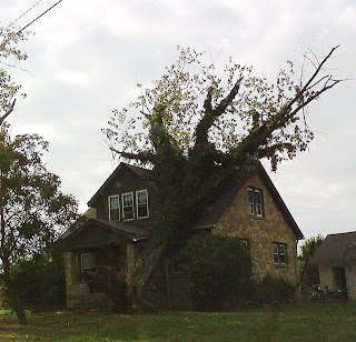
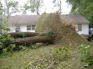
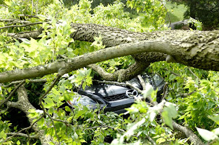
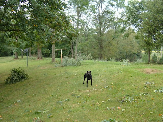
Here are some pictures from across the area. Click on the picture for a larger view.
An interesting side note about the storm. Once the worst of the storm was over, the local grocery stores (that had power and were still open) were flooded with shoppers looking to buy the basics needed to fix meals with no electricity. The empty shelves above are usually packed with loaves of bread, but not this time.


Another problem found was the lack of gasoline. So many gas stations were without power that everyone was pumping from the ones that did have power. As a result, those stations began to run out of gasoline.
Here at the house, I didn't have any damage to the house itself, but several tree limbs were blown down. One tree was even split in two.

 Could we be entering another drought? It certainly has been dry the past several weeks. So far in the month of September we've only had 0.95 inches of rainfall. That is less than half of what we should get over the entire month. The last time we had significant rainfall greater than a tenth of an inch was September 12 when 0.22 inches fell. The drought monitor does not currently have our area in the "abnormally dry" shading yet, but I think when the new monitor is issued on Thursday, September 25 we'll skip abnormally dry and go straight to the moderate drought shading. Time will tell.


